Larry Hudson and I decided to ride the Tennessee portion of the trail during the first week of October. Larry is from Olney, Illinois. Olney is a town just north of Mt. Carmel. the town where I live. Larry was on his KLR 650 and I rode my little Yamaha WR250R.
We left Illinois on a rainy Sunday morning, and rode all the way down to Bowling Green, Kentucky, in a continual mist peppered with ocassional sprinkles.
We arrived in Tellico Plains the next evening and met up with my friend, Rick Pease, who lives up in the mountains just south of town.
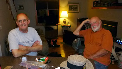
This is Larry and Rick at Rick's house in Tellico Plains. Thanks Rick for allowing us to stay at your bachelor pad overnight. You were a great host.
Once the Trans-American Trail leaves Tellico Plains, it immediately starts up gravel roads. Those roads were not very hard to ride, but it was very difficult for us to follow the route. Thankfully, we had it well marked on a roll chart which I kept attached to the handle bars of my bike.
It was beautiful up in the Appalachian hills around Tellico Plains. We passed a lot of campgrounds and lakes hidden away in the mountains.
Unfortunately, much of the Trans-America Trail in Tennessee is paved over. It is still beautiful though, and lots of fun to ride. It twists and turns every half mile or so. Route finding is really a challenge.
Even on the paved portions it was still absolutely a feast for the eyes. There was something to see at every curve: deer, wild turkeys, groundhogs, and houses with people on their porches and in their yards, watching us with great curiosity as we motored past. Appalachia has really changed. Not long ago the homes would have had granny smoking her pipe on a beaten up couch out in the front yard. Once in a while you can still see some of those old houses.
The farther west we went in Tennessee, the more gravel roads we ran into. We seldom saw a car. We started to run into a lot of water crossings. This is one of the smaller ones.
I especially liked the river crossings we found in the deep woods in western Tennessee. When I rode across this one I kept thinking that I was glad both the air breather and the exhaust are up above the engine on these bikes.
By this time I was riding alone. Larry had to be back in Illinois. I sure did miss his company.
Can you see the road on the other side of the creek in that last picture. This was certainly a pretty part of the trail. It was just before crossing over into Mississippi.
The Tennessee River is close to the Tennessee/Mississippi border. I don't think I will be riding my bike through it. Gotta find a bridge.
Once in Mississippi, the first thing on the agenda is to change over the roll chart that gives us directions on when and where to turn. Route finding is a challenge. Thank goodness for the roll charts, and also for the GPS, because every once in a while the roads were closed. When that happened, I had to look at the coordinates on the chart and put them into my GPS to a way around where we could get back on the trail again.
The Mississippi portion of the Trans-American Trail goes across the hill country in Northern Mississippi. Part of the trail up there is through sand.
There were a lot of very wet places. These were miles from any place where a man could get help. I was sure glad that I didn't have any trouble.
There was a lot of poverty in that area. I could not believe how some of the people were living up in those hills. If I had problems, I think I would have been pretty nervous about asking for help.
I didn't stop to get any pictures of them or of their houses/trailers. I wish I had, but I think stopping would get a man shot (or at least attacked by the dogs that each of those places had lounging around in the trash-filled yards).
By that time storms starting rolling in from out of the west. Tornados, lightning and thunderstorms were predicted. If it started to rain, those dirt roads would have become impossible quagmires. Time to head home.
I rode north along the Natchez Trace Parkway, just just zipping along and making great time as I outran the slow-moving storm system. I had to keep a constant eye out for deer though -- wouldn't want to hit one of them at 60 miles per hour.
The Natchez Trace Parkway, in case you don't know, is hundreds of miles long. It is a long national park, and no commercial vehicles are allowed on it. It is absolutely beautiful. It passes caves and springs and Indian mounds, and dozens of wild turkeys standing along the road and watching the sparse traffic go by.
From where I stopped, the Trans-American Trail goes through the Ozark Mountains in Northern Arkansas. That should be pretty, but it is for another day.
More later.
Ron


